The David Rumsey Map Collection website has an impressive collection of over 150,000 maps. One of the maps found on there was compiled by Josephine Wilhelm Wickser and drawn by Mildred C. Green in 1931.
This map features important historical events, buildings, and portraits from both sides of the Niagara River featuring Canada and portions of Niagara and Erie Counties, New York.
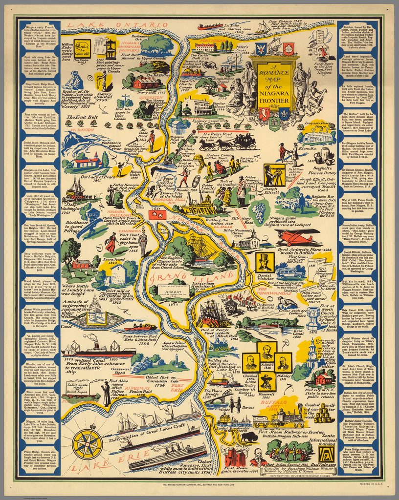
To view, zoom in, and download the map, click this link: https://www.davidrumsey.com/luna/servlet/s/a87dtz.
I love how this map was created by two women!
TAGS :
Maps Niagara County